
Quality
Source Protection Plan for the Niagara Peninsula Source Protection Area
Effective October 01, 2014, this plan, mandated by the province under the Clean Water Act, 2006 (Ontario Regulation 287/07), was approved by the Ontario Minister of the Environment. The goal of the plan is to protect drinking water quality at its source, and stop contaminants from getting into sources of drinking water (lakes, rivers and aquifers).
Source Water is defined as: water in its natural or raw state, prior to being withdrawn into the drinking water system. A Water Source is defined as: an aquifer or surface water body being used to supply drinking water.
The Niagara Peninsula Source Protection Area (NPSPA) is located between Lake Ontario and Lake Erie, and covers the same area as the Niagara Peninsula Conservation Authority (NPCA).
The NPSPA is 2,424 square kilometers in size, and the jurisdiction covers the Regional Municipality of Niagara (including all 12 local municipalities within Niagara), and approximately 20% of the City of Hamilton and 25% of Haldimand County.
The source protection plan is a series of policies developed in consultation with the local community to protect municipal drinking water sources. The policies apply within Intake Protection Zones (IPZ) where significant drinking water threats may occur.
Table 1.1 Water Treatment Plants and Intake Protection Zones in Niagara

*Table Note: There is no Welland IPZ-2 since it is located wholly within the IPZ-1.
Under the CWA (Clean Water Act, Ontario), an IPZ-1 or IPZ-2 will contain significant drinking water threats if the vulnerability score assigned to it is 8.0 or greater. Table 1.2 shows the IPZs that have vulnerability scores of 8.0 or greater assigned to them.
Table 1.2 Intake Protection Zones with Vulnerability Scores of 8 or Greater

The IPZ-1s and IPZ-2s for Welland, Grimsby and Rosehill Water Treatment Plants, and the DeCew Falls and Niagara Falls IPZ-2s all have vulnerability scores less than 8.0, and therefore cannot contain significant drinking water threats (unless specific event-based contaminant modeling is performed). Of course, areas outside IPZs 1 and 2 also cannot contain significant threats unless specific event-based contaminant modeling is performed.
Source: www.sourceprotection-niagara.ca
Retrieved From: http://www.niagaraknowledgeexchange.com/resources-publications/source-protection-plan-for-the-niagara-peninsula-source-protection-area/
Wainfleet Boil Water Advisory
Niagara Region Public Health (NRPH) issued a boil water advisory for the Township of Wainfleet on April 10, 2006, that still remains in effect and is posted on the NRPH website. The advisory contains the following detail:
Municipal water and sewer services do not exist in the Township of Wainfleet. Residents rely on private water well supplies, and on-site sewage disposal (septic systems). Niagara Region Public Health reminds residents the boil water advisory, issued on April 10, 2006, remains in effect. The initial advisory was issued after extensive consultation with a panel of national, medical and technical experts, and receiving advice from the Chief Medical Officer of Health of Ontario.
This advisory applies to all properties located in the area south of the Trans Canada Trail (former CN railway) and extending to the Lake Erie shoreline in the Township of Wainfleet. Significant bacterial contamination exists in the groundwater source for private and communal wells in that area. Individuals drawing drinking water from a well using this groundwater source remain at a significant health risk.
Residents are strongly advised to boil water and allow it to boil for one full minute before using it. This includes water used for drinking, cleaning fruit or vegetables, making ice, juice, puddings and other mixes, brushing teeth, or any activity involving children where they may have the opportunity to drink or swallow water, such as bathing. Bottled water is recommended as an alternative.
Source: Niagara Region Public Health
Retrieved From: http://www.niagararegion.ca/living/health_wellness/wainfleet/
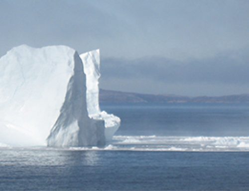
Niagara Peninsula Conservation Authority (NPCA) Water Quality Report 2014
The NPCA covers the Regional Municipality of Niagara and approximately 20% of the City of Hamilton and 25% of Haldimand County. In 2013 the NPCA monitored surface water quality at 73 stations covering 41 watersheds.
For surface water, the biological and chemical monitoring results indicate that most of the NPCA’s watersheds have poor or impaired water quality. Total phosphorus, E. coli, suspended solids, and chlorides from non-point sources (agricultural/livestock runoff, faulty septic systems) and point sources (combined sewer overflow, urban stormwater) continue to be the major causes of impairment in the NPCA watershed.
Water quality ratings improved in several watersheds when 2002-2008 water quality data was compared to 2009-2013 data. Twelve Mile Creek continues to have the best water quality rating in the NPCA watershed.
Source: NPCA
Retrieved From: http://www.npca.ca/wp-content/uploads/2014-Water-Quality-Report-web.pdf
The Niagara Region Public Health Beach Monitoring map includes status information about a total of 25 beaches, 9 of which are on Lake Ontario, including 1 in Niagara-on-the-Lake, 3 in St. Catharines, 2 in the Town of Lincoln, and 3 in Grimsby. A total of 16 on Lake Erie include 5 in Fort Erie, 5 in Port Colborne, and 6 in Wainfleet.
Four Environment Canada weather stations, one each in Lincoln, St. Catharines, Niagara Falls and Welland are also included on this map; they show temperature, relative humidity, wind speed, wind gust and wind direction.
Source: Niagara Region Public Health
Retrieved From: http://maps.niagararegion.ca/beachmonitoring/
Niagara’s Beaches: Hidden Gems, a June 2013 policy brief by the Niagara Community Observatory looks at how people in, and visitors to Niagara utilize our beaches; the current and historic factors affecting water and beach quality; and how beach quality is monitored and reported.
The brief states that in summer, Bay (Crystal) Beach on Lake Erie draws more than 2,000 visitors per day, including some from south of the border. Industrial, residential and agricultural pollutants and rising water temperatures have affected beach quality in the past and there have been continuing efforts to increase water quality in the Great Lakes. The risks for swimmers and beach-goers are monitored and reported by a team of Niagara Region Public Health staff who ensure the most accurate beach quality reporting possible.
The brief notes that beach quality is affected by a variety of environmental, physical and human factors, and provides conclusions about what we can do to improve beach water quality:
- Continued reduction of phosphates in soaps and detergents would help reduce algal growth. Restricting the phosphates in laundry detergents in the 1970s successfully reduced the algal blooms in Lake Erie.
- Consumers can choose phosphate-free and organic detergents to help improve water quality.
- Continuing to restrict agricultural and residential fertilizers from entering the water systems will also improve beach and water quality. Residential fertilizers typically contain nitrogen and phosphorous and when used correctly, can promote plant growth without harming the environment. But when misused, fertilizers can seep into storm sewers and enter local water sources resulting in too many nutrients in the water and contributing to algal growth. Making sure to use fertilizers according to recommendations and applying fertilizers on areas that have enough organic material to act as a filter can help.
- Tackle storm-water runoff by identifying problem areas and developing “buffer zones” made up of grass or trees to slow and filter the runoff.
- Continue to separate storm water and household sewage systems to reduce the propensity for wastewater system overloads during heavy rainfall periods. Older neighbourhoods were built with storm sewer and household sewage systems combined. During heavy rainfalls, the sewage systems can become overloaded and result in flooded basements or combined sewer overflows that expel untreated water into rivers and lakes.
- Assuring that communities have adequate wastewater treatment capacity and continuing to replace older combined sewers will help reduce the amount of untreated waste entering local water sources.
- Reducing water consumption during heavy rainfalls can help reduce overflows.
Source: NCO Policy Brief #15 – Niagara’s Beaches: Hidden Gems
Retrieved From: http://www.niagaraknowledgeexchange.com/resources-publications/niagaras-beaches-hidden-gems/
Quantity
Liquid Assets: Assessing Water’s Contribution to Niagara is a 2013 report that looks at the state of knowledge of how, and in what quantities water contributes to the well-being of Niagara. How water is governed, and how climate change may impact water resources in Niagara are also topics covered.
Three main requirements for Niagara were identified by the report:
- Water use and value information that is current, relevant for the region, and available from a central agency.
- Maintain a current understanding of how the complex web of water governance operates in Niagara, to minimize ongoing and potential conflicts.
- Gain a strong understanding of the region’s vulnerabilities, and areas where adaptive capacity exists to minimize negative impacts of climate change to Niagara’s well-being.
Source: Environmental Sustainability Research Centre, Brock University
Retrieved From: http://www.niagaraknowledgeexchange.com/wp-content/uploads/sites/2/2014/05/LIQUID_ASSETS_ASSESSING_WATERS_CONTRIBUTION_TO_NIAGARA.pdf